

-
About District
About District
History - Tradition
Geographic & Economic
Miscellaneous
-
District Administration
Deputy Commissioner
DC Office
DDLG/ADCs
Officers and Staff
Section Related
Important Information
Innovation Activities
-
Govt. Offices
Security & Discipline Affairs
Education & Culture
-
District Primary Education office
-
District Education office
-
District Non-formal Education Bureau
-
Shilpa Kola academy
-
Bangladesh Shishu Academy
-
District sports office
-
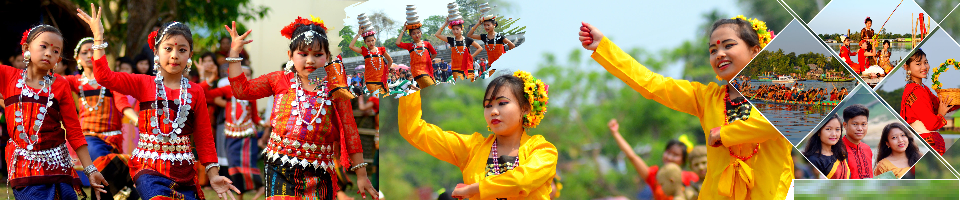
Cultural Institution of Small Ethnic Groups
-
District Govt. Public Library
-
Primary Training Center (PTI)
-
Temple based children and mass education activities
Agriculture & Food Affairs
-
Agriculture Extension Dept.
-
Dist. Food Controller Office
-
District Fisheries Office
-
District Livestock Office
-
Dept. of Jute
-
BADC (Seeds)
-
Office of the Senior Agricultural Marketing Officer
-
District Artificial Reproductive Center, Khagrachhari
-
District Seed Certification Agency
-
Bangladesh Food Safety Authority
-
Cotton Development Board
-
Deputy Director Office, Horticulture Center, Khagrachari
-
District BADC (IR) Office
-
Hill Agricultural Research Center
Health Affairs
Engineering
Communication & Engineering
Human Resources Development Affairs
-
Office of the Deputy Director, Department of Youth Development
-
Jatiyo Mohila Sangstha
-
Protibondhi Seba O Sahajjo Kendro, Khagrachari Hill District
-
District Employment and Manpower Office
-
District Cooperative Office
-
Office of the District Women Affairs Officer
-
District Social Services Office
-
Urban Social Services Office
-
Bangladesh Rural Development Board
-
Government Child Family (Mixed)
-
Hospital Social Services Office
Other Offices
-
District Election Office
-
District Accounts Office
-
Bangladesh Tourism Corporation
-
District Statistics Office
-
Islamic Foundation
-
District Savings Office
-
Bangladesh Small and Cottage Industries Corporation (BSCIC)
-
Task Force on Tribal Refugees
-
Probation Officer's office, Khagrachhari
-
Khagrachhari Forest Department
-
Dept of Environment, District Office, Khagrachhari Hill District
-
District Regional Passport Office
-
District Primary Education office
-
Local Government
-
Other Institutions
Educational Institutions
Organization
Non-governmental organizations
Religious institutions
CHT Ministry Affairs Offices
-
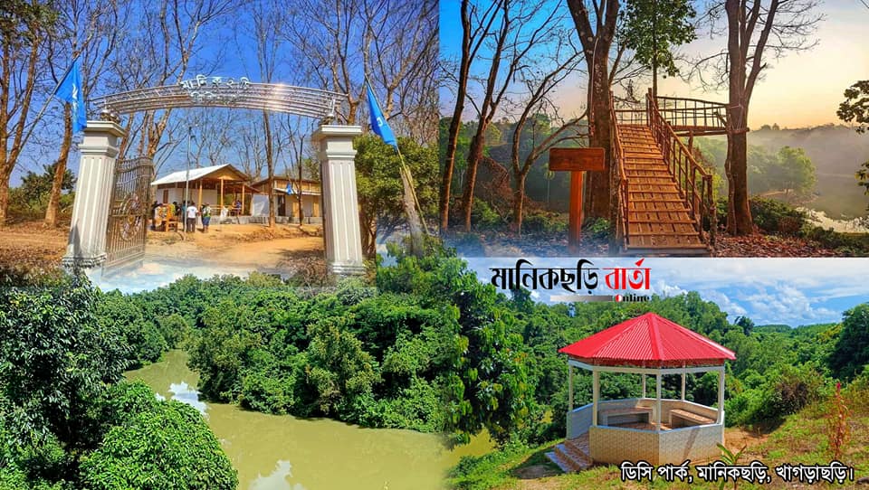
Gallery
Gallery
-
Online Services
Permanent Resident Certificate
Service Delivery Process Map
Succession certificate
Travel Permit for Foreign Nationals
Online Ticket Purchase
-
Tourism Cell
Focal Point Officer
Hotel & Restaurant List
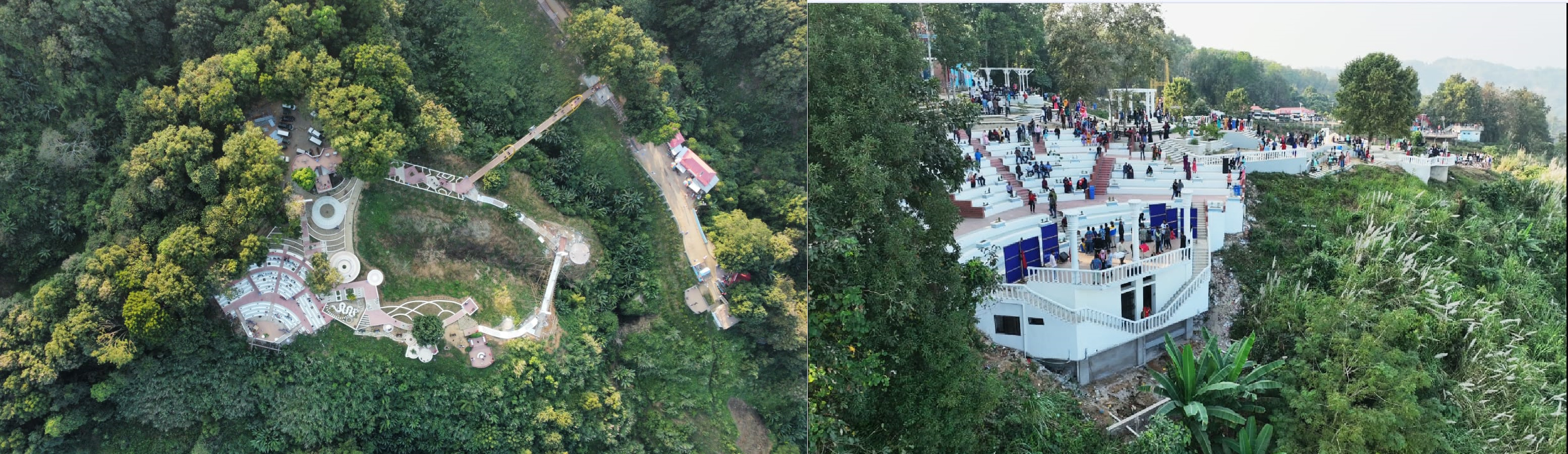
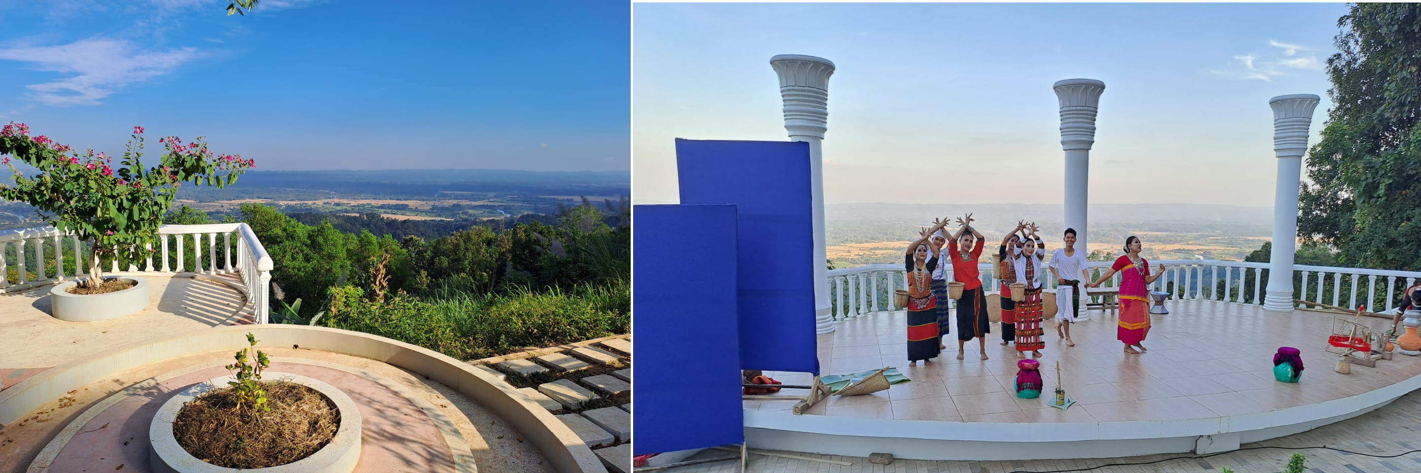
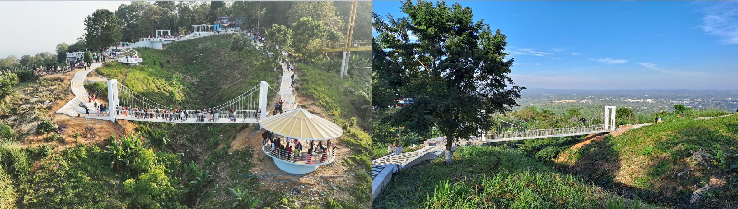
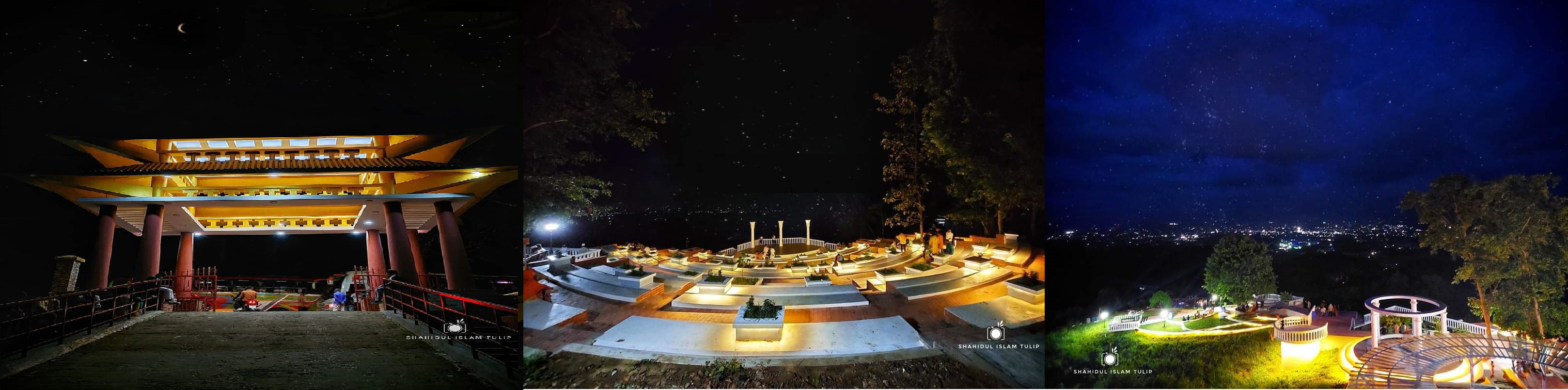
- July Memorial Day Celebration Program
-
About District
About District
History - Tradition
Geographic & Economic
Miscellaneous
-
District Administration
Deputy Commissioner
DC Office
DDLG/ADCs
Officers and Staff
Section Related
Important Information
Innovation Activities
-
Govt. Offices
Security & Discipline Affairs
Education & Culture
- District Primary Education office
- District Education office
- District Non-formal Education Bureau
- Shilpa Kola academy
- Bangladesh Shishu Academy
- District sports office
- Cultural Institution of Small Ethnic Groups
- District Govt. Public Library
- Primary Training Center (PTI)
- Temple based children and mass education activities
Agriculture & Food Affairs
- Agriculture Extension Dept.
- Dist. Food Controller Office
- District Fisheries Office
- District Livestock Office
- Dept. of Jute
- BADC (Seeds)
- Office of the Senior Agricultural Marketing Officer
- District Artificial Reproductive Center, Khagrachhari
- District Seed Certification Agency
- Bangladesh Food Safety Authority
- Cotton Development Board
- Deputy Director Office, Horticulture Center, Khagrachari
- District BADC (IR) Office
- Hill Agricultural Research Center
Health Affairs
Engineering
Communication & Engineering
Human Resources Development Affairs
- Office of the Deputy Director, Department of Youth Development
- Jatiyo Mohila Sangstha
- Protibondhi Seba O Sahajjo Kendro, Khagrachari Hill District
- District Employment and Manpower Office
- District Cooperative Office
- Office of the District Women Affairs Officer
- District Social Services Office
- Urban Social Services Office
- Bangladesh Rural Development Board
- Government Child Family (Mixed)
- Hospital Social Services Office
Other Offices
- District Election Office
- District Accounts Office
- Bangladesh Tourism Corporation
- District Statistics Office
- Islamic Foundation
- District Savings Office
- Bangladesh Small and Cottage Industries Corporation (BSCIC)
- Task Force on Tribal Refugees
- Probation Officer's office, Khagrachhari
- Khagrachhari Forest Department
- Dept of Environment, District Office, Khagrachhari Hill District
- District Regional Passport Office
-
Local Government
-
Other Institutions
Educational Institutions
Organization
Non-governmental organizations
Religious institutions
CHT Ministry Affairs Offices
-
Gallery
Gallery
-
Online Services
Permanent Resident Certificate
Service Delivery Process Map
Succession certificate
Travel Permit for Foreign Nationals
Online Ticket Purchase
-
Tourism Cell
Focal Point Officer
Hotel & Restaurant List
-
July Memorial Day Celebration Program
July Memorial Day Celebration Program
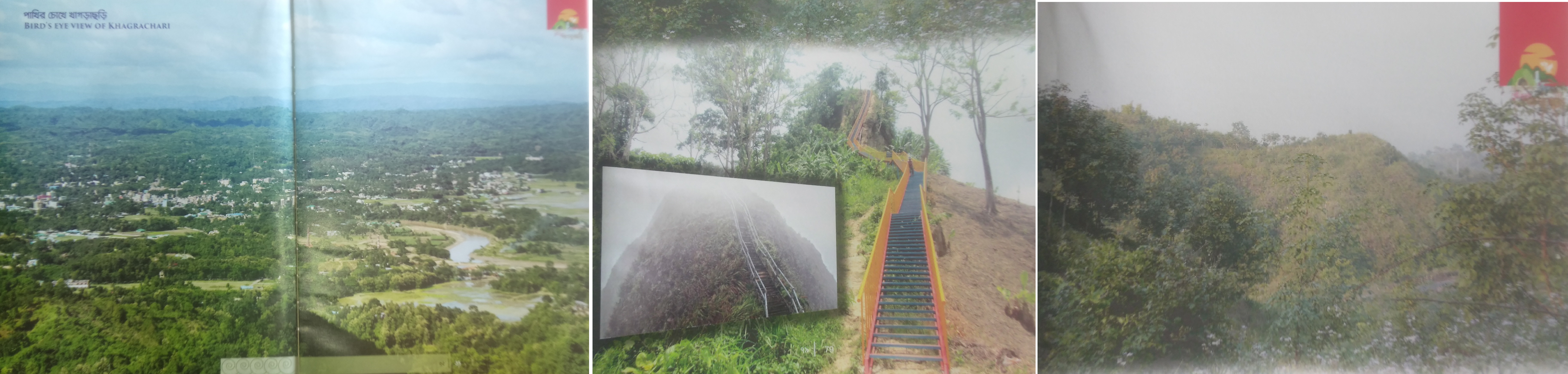
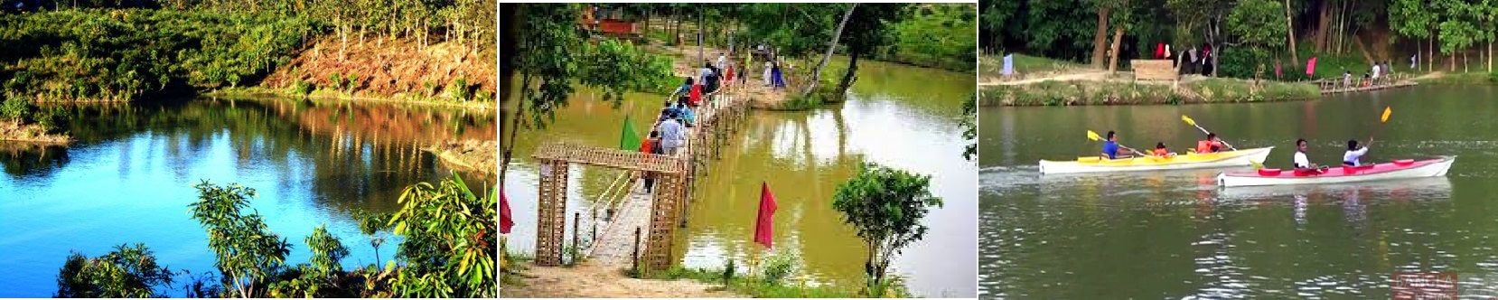
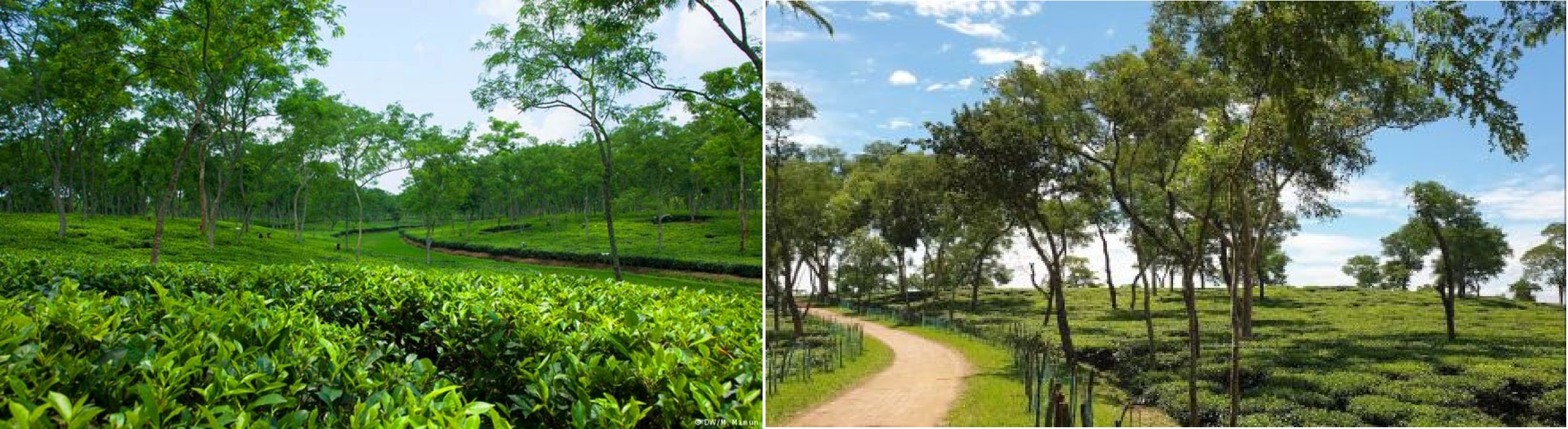
Introduction: Khagrachhari Hill District was formed on 7 November 1983. It is located at 22.38 degrees to 23.44 degrees north latitude and 91.42 degrees to 92.11 degrees east longitude. Combined with hills, small rivers, rhymes and plains, it is a beautiful wave playing area. Notable rivers of the district are Chengi, Maini and Feni. In addition, it has 338 ponds, reservoirs and lakes of which 8% are khas. The district is bounded on the north and west by the Indian state of Tripura, on the south by Chittagong and Rangamati districts and on the east by Rangamati district. The total area is 2699.55 sq km. High land area is about 75% and flat land area is 15% (approximately). There are a total of 121 mouzas in the district including 7 Mong Circles and 33 Chakma Circles. Areas under Mong Circle are Khagrachhari Sadar, Matiranga, Ramgarh, Manikchhari, Mahalchhari, Panchhari and part of Laxmichari Upazila and part of Chakmicha Circle under Laxmichari Upazila and Dighinala Upazila. Number of villages 353, unions 35, upazilas 09, thanas 09, municipalities 03. Administration: There are 09 (nine) upazilas in this district. These are Khagrachhari Sadar, Matiranga, Guimara, Ramgarh, Manikchhari, Laxmichari, Mahalchhari, Dighinala and Panchhari. The Khagrachhari Hill District Council was established in 1996 under the Khagrachhari Hill District Local Government Council (Amendment) Act, 1997. This council is working under the Ministry of Chittagong Hill Tracts Affairs.
HISTORICAL BACKGROUND OF KHAGRACHARI: A review of history reveals that from the 6th century AD to the 14th century AD, the area was once ruled by Tripura, or Arkan kingdoms. Among them, the Tripura kings ruled the Chittagong Hill Tracts (including Khagrachhari) and Chittagong for a total of 363 years from 590 to 953 AD. Thereafter, from 953 AD to 1240 AD, the Arkan kings ruled the area for 296 years, but then for another 102 years (up to 1342 AD) the Tripura kings again ruled the area. Historically, from the 10th to the 15th century, the Tripura kings occupied the area 08 (eight) times, the Arakan kings 09 (nine) times and the Sultans of Gaur (Muslim) 08 (six) times. Finally, from 1342 AD, the Muslim ruler Sultan Fakruddin Mubarak Shah took control of the area, including Chittagong, under the rule of the Tripura king. Following the occupation of the masnad of Bengal by the East India Company in 1757 AD under the continuation of Muslim rule, the British government occupied Chittagong from the hands of Nawab Mir Qasim in 160 AD during the reign of Nawab Mir Qasim Ali Khan. Then on 14 February 161 AD, the war of independent Tripura Maharaja took place with the British government. An agreement was reached between the two in the wake of the defeat of the king of Tripura in the war. Article 3 of the treaty states that "the revenue and administrative executive power of the Chittagong Hill Tracts shall be vested in the British Government". The British government finally gained control of Chittagong Hill Tracts (partially) from Mir Qasim, Nawab of Bengal in October 160 AD and from the Maharaja of Tripura in 175 AD. Thereafter, according to Notification No. 3302 dated 26th June, 180 AD, the Chittagong Hill Tracts was separated from Chittagong and declared as a separate district. Later, the British government divided the Chittagong Hill Tracts into three circles named Mong, Chakma and Bomang on September 1, 161 AD to facilitate governance and revenue collection. In addition, the British government introduced the "Chittagong Hill Tracts Frontier Police Act" in 181 and established a separate police force consisting of local tribals. Since the declaration of Chittagong Hill Tracts as a district, it was governed by Act No. 22 of 180 AD, Act No. 4 of 183 AD, Rule No. 3 of 183 AD and Rule No. 3 of 181 AD. On May 1, 1900, the British government enacted another law, the Chittagong Hill Tracts Regulation 1900 Act. Based on this law, three hill districts of the Chittagong Hill Tracts have been governed since 1900 AD. It is to be noted that although the Government of India Act was passed in 1935, the Chittagong Hill Tracts Rules Act of 1900 continued in the region; Strict restrictions were imposed on the sub-tribes coming from other districts to get land settlement in this district. During the British rule, Chittagong Hill Tracts Excluded Area from 1920 AD, Tribal Area from 1962 AD, Chittagong Hill Tracts Regulation-1900 Act from 1974 was repealed and this area was considered as a general area. Later, in response to the demands of the political leaders, the then government re-enacted the Chittagong Hill Tracts Regulation 1900 Act in an executive order: declaring the area a Tribal Area. At that time the then government, in an effort to bring population balance between Bengalis and tribals in the area, made various amendments to the rules to facilitate the tribals to acquire land ownership in the area. At various times during the post-independence period, the government continued its efforts to balance the population between the tribes and sub-tribes. Mango of the Awami League government in continuation of the political background of the highlands


Planning and Implementation: Cabinet Division, A2I, BCC, DoICT and BASIS
Technical Assistance:
![]()
Developed By:
